GIS System
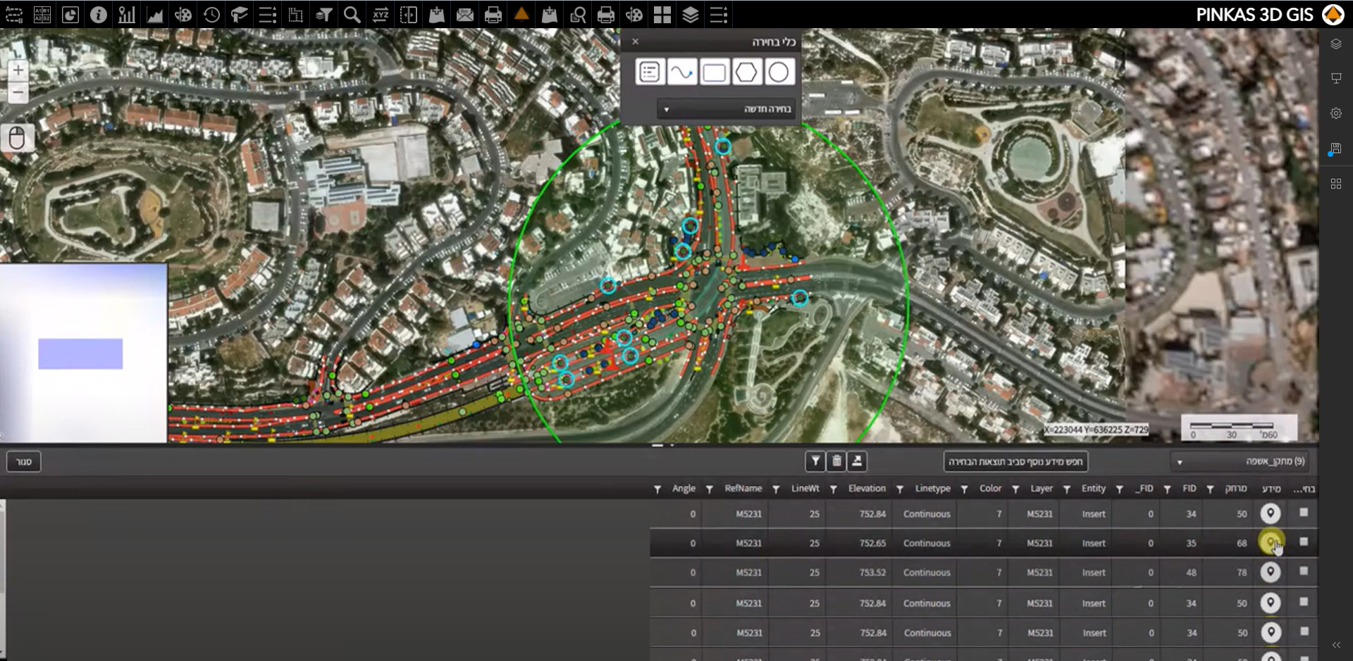
The SHER GIS system was developed by Pinkas Group, based on its 70 years of expertise and work with its customers, and has been adapted to meet the needs of the AEC (Architecture, Engineering, and Construction) industry.
The system is “smart”, using advanced technology based on Esri, supporting most engineering and geographical formats, and is accessible online. The GIS SHER system was developed by Pinkas Group, based on 70 years of expertise and work with its client, and has been adapted to meet the needs of the AEC (Architecture, Engineering, Construction) industry.
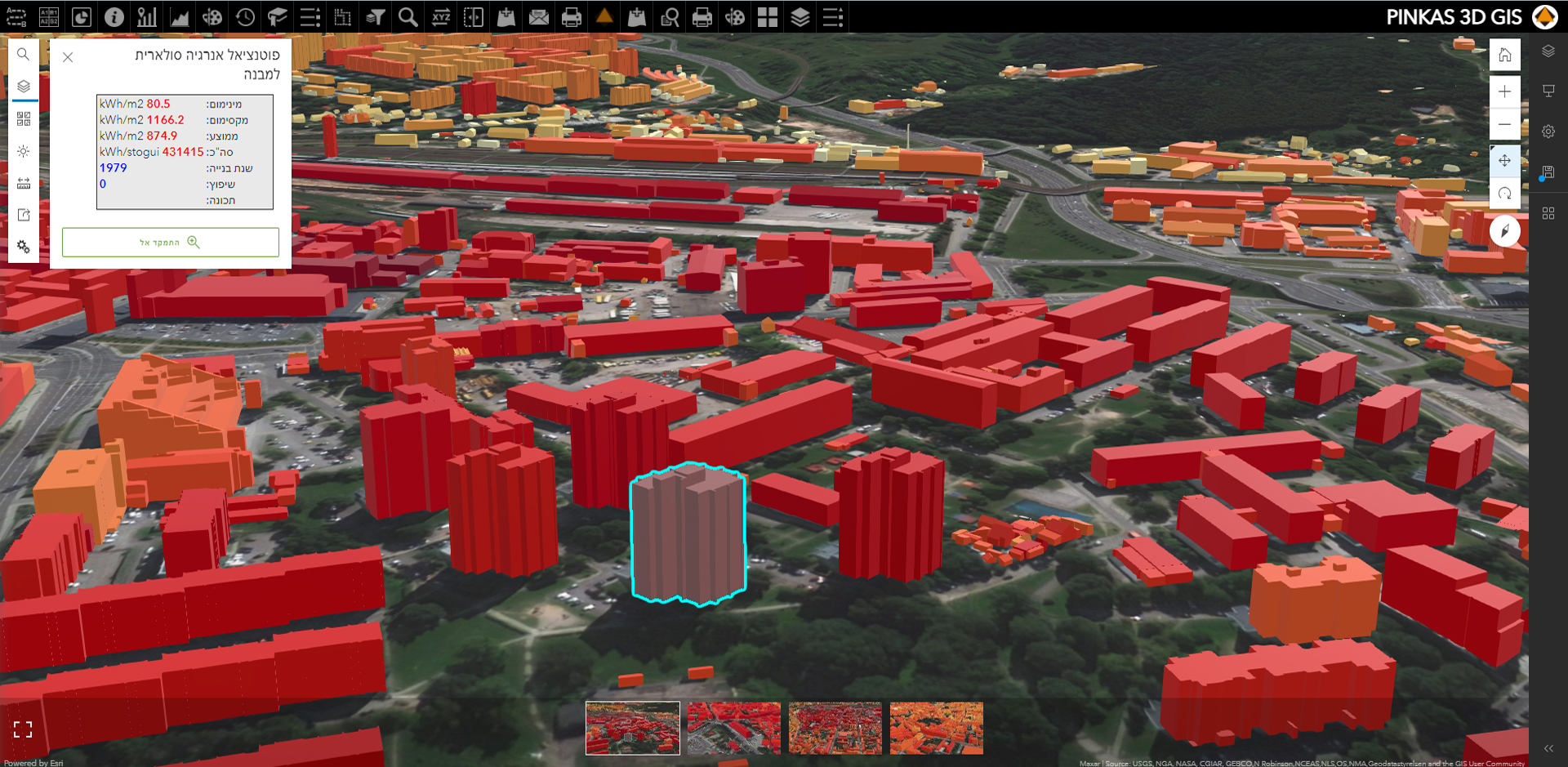
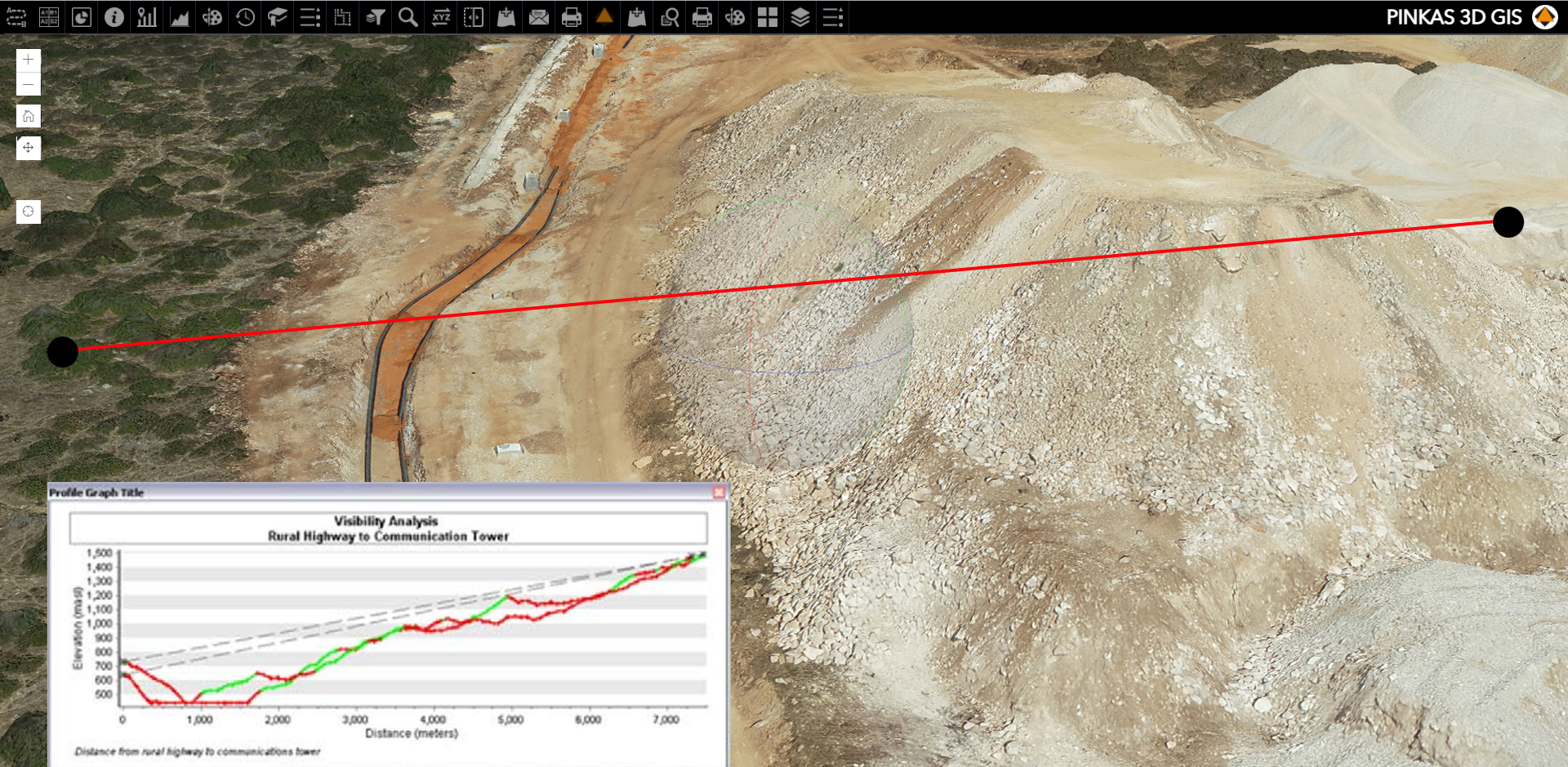
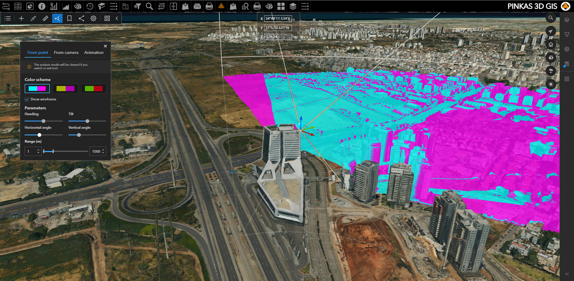
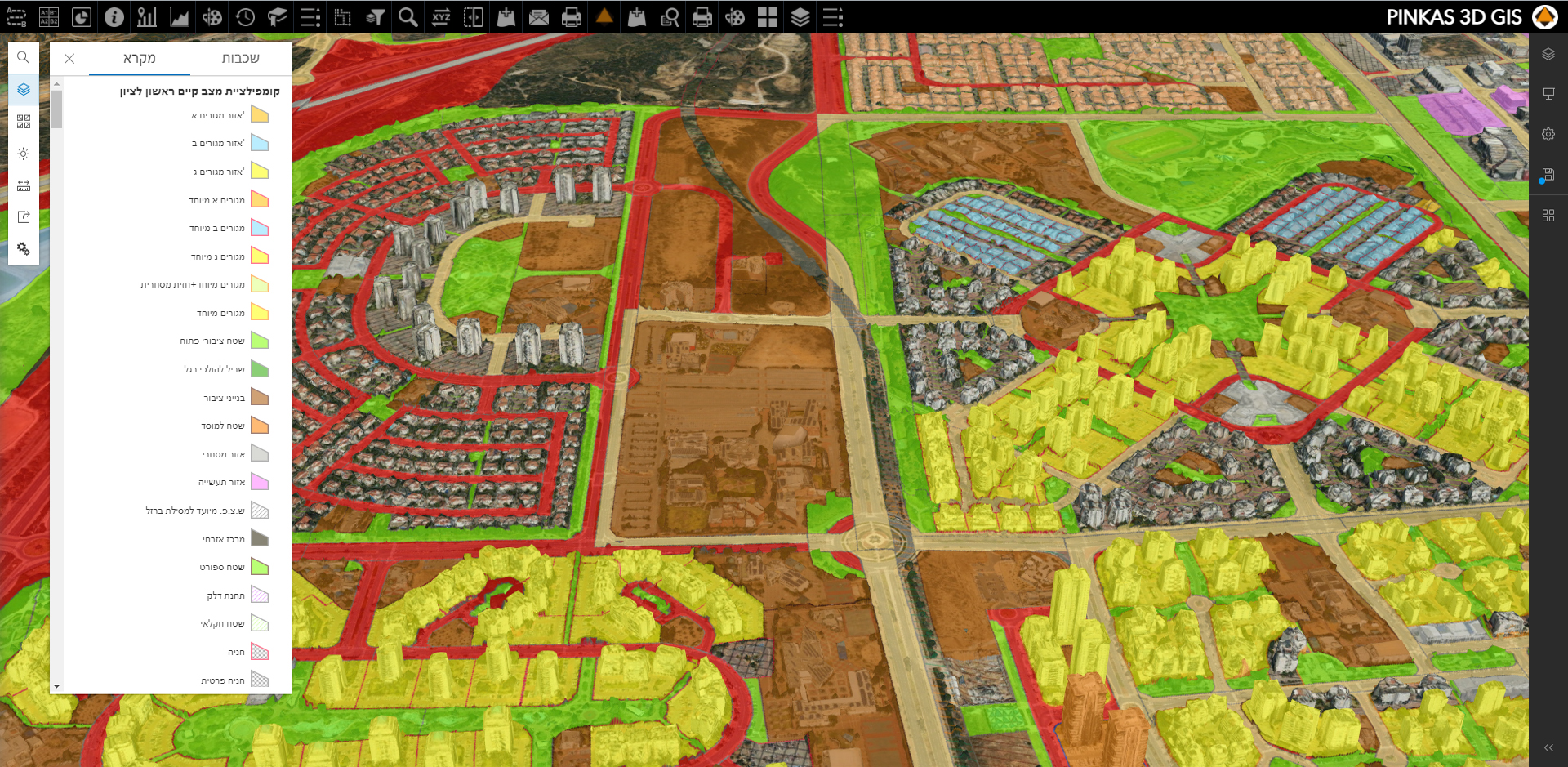
Geospatial analysis in 2D and 3D environments
Sharing of geographic and engineering information from anywhere, anytime and from any platform.
The eyes of the project—allows one to receive reliable, up-to-date information about work completed in the field.
Viewing and analyzing data, including a variety of management reports based on interactions with the environment.
Modules in the system allow the tools and capabilities to be customized for each department and for each organization.
Streaming services and system synchronization tools allow integration with other systems.
The SHER system from Pinkas Group is a winning technology for gathering, organizing, and analyzing spatial information and is a powerful and necessary tool in the decision-making and project management process.