Pinkas Group has been doing aerial photography for more than 20 years.
Photographs are taken by aircraft- and drone-mounted camera systems owned by the group and approved by the Israel Mapping Center for orthophoto and photogrammetric mapping in accordance with surveying regulations.
Play Video
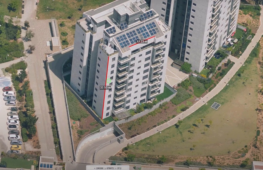
Aerial orthophoto, Rishon Letzion
Vertical Aerial Photography
A basis for surveying at scales starting at 1:250.
Vertical air photography at resolutions starting from 2.5 cm per pixel in accordance with surveying regulations.
Play Video
oblique photos
Aerial photography with assistance of five cameras viewing objects from five directions. Images are used as raw data for simulating the area in 3D.
Photo resolution starting at 2.5 cm per pixel (1:250 scale).